

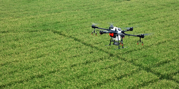
Aircraft
-
Takeoff Weight
-
1487 g
-
Diagonal Distance (Propellers Excluded)
-
350 mm
-
Max Service Ceiling Above Sea Level
-
19685 ft (6000 m)
-
Max Ascent Speed
-
6 m/s (automatic flight); 5 m/s (manual control)
-
Max Descent Speed
-
3 m/s
-
Max Speed
-
31 mph (50 kph) (P-mode); 36 mph (58 kph) (A-mode)
-
Max Flight Time
-
Approx. 27 minutes
-
Operating Temperature
-
0° to 40° C (32° to 104° F)
-
Operating Frequency
-
2.4000 GHz to 2.4835 GHz (Europe, Japan, Korea)
5.725 GHz to 5.850 GHz (Other countries/regions)[1]
-
Transmission Power (EIRP)
-
2.4 GHz: < 20 dBm (CE / MIC / KCC)
5.8 GHz: < 26 dBm (FCC / SRRC / NCC)
-
Hover Accuracy Range
-
RTK enabled and functioning properly:
Vertical: ± 0.1 m; Horizontal: ± 0.1 m
RTK disabled:
Vertical: ± 0.1 m (with vision positioning); ± 0.5 m (with GNSS positioning)
Horizontal: ± 0.3 m (with vision positioning); ± 1.5 m (with GNSS positioning)
-
Image Position Compensation
-
The relative positions of the centers of the six cameras’ CMOS and the phase center of the onboard D-RTK antenna have been calibrated and are recorded in the EXIF data of each image.
Mapping Functions
-
Ground Sample Distance (GSD)
-
(H/18.9) cm/pixel, H indicates the aircraft altitude relative to the area mapped (unit: m)
-
Rate of Data Collection
-
Max operating area of approx. 0.63 km2 for a single flight at an altitude of 180 m, i.e., GSD is approx. 9.52 cm/pixel, with a forward overlap rate of 80% and a side overlap ratio of 60%, during a flight that drains the battery from 100% to 30%.
GNSS
-
Single-Frequency High-Sensitivity GNSS
-
GPS + BeiDou + Galileo[2] (Asia); GPS + GLONASS + Galileo[2] (other regions)
-
Multi-Frequency Multi-System High-Precision RTK GNSS
-
Frequency Used
GPS: L1/L2; GLONASS: L1/L2; BeiDou: B1/B2; Galileo[2]: E1/E5
First-Fixed Time: < 50 s
Positioning Accuracy: Vertical 1.5 cm + 1 ppm (RMS); Horizontal 1 cm + 1 ppm (RMS).
1 ppm indicates error with a 1 mm increase over 1 km of movement.
Velocity Accuracy: 0.03 m/s
Gimbal
-
Controllable Range
-
Tilt: -90° to +30°
Vision System
-
Velocity Range
-
≤ 31 mph (50 kph) at 6.6 ft (2 m) above ground with adequate lighting
-
Altitude Range
-
0 – 33 ft (0 – 10 m)
-
Operating Range
-
0 – 33 ft (0 – 10 m)
-
Obstacle Sensory Range
-
2 – 98 ft (0.7 – 30 m)
-
Operating Environment
-
Surfaces with clear patterns and adequate lighting (> 15 lux)
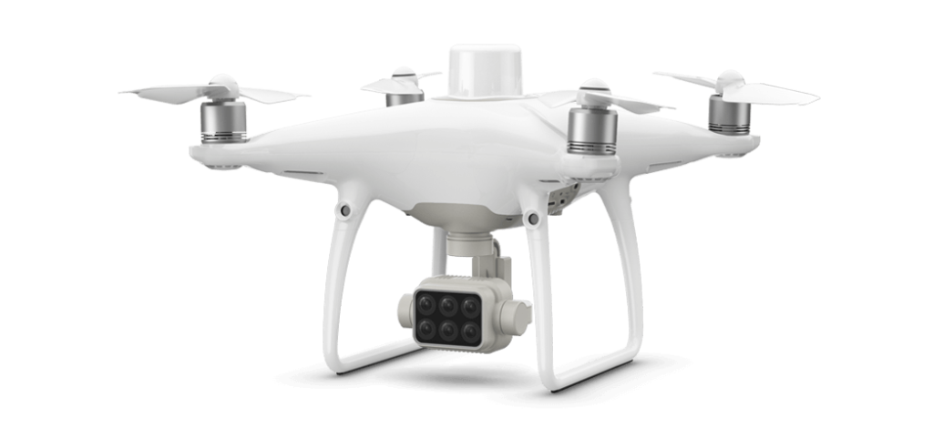
Camera
-
Sensors
-
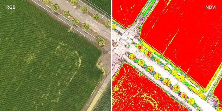
Six 1/2.9” CMOS, including one RGB sensor for visible light imaging and five monochrome sensors for multispectral imaging.
Each Sensor: Effective pixels 2.08 MP (2.12 MP in total)
-
Filters
-
Blue (B): 450 nm ± 16 nm; Green (G): 560 nm ± 16 nm; Red (R): 650 nm ± 16 nm; Red edge (RE): 730 nm ± 16 nm; Near-infrared (NIR): 840 nm ± 26 nm
-
Lenses
-
FOV (Field of View): 62.7°
Focal Length: 5.74 mm (35 mm format equivalent: 40 mm), autofocus set at ∞
Aperture: f/2.2
-
RGB Sensor ISO Range
-
200 – 800
-
Monochrome Sensor Gain
-
1 – 8x
-
Electronic Global Shutter
-
1/100 – 1/20000 s (visible light imaging); 1/100 – 1/10000 s (multispectral imaging)
-
Max Image Size
-
1600×1300 (4:3.25)
-
Photo Format
-
JPEG (visible light imaging) + TIFF (multispectral imaging)
-
Supported File Systems
-
FAT32 (£ 32 GB); exFAT (> 32 GB)
-
Supported SD Cards
-
microSD with a minimum write speed of 15 MB/s. Max Capacity: 128 GB. Class 10 or UHS-1 rating required
-
Operating Temperature
-
0° to 40° C (32° to 104° F)
Remote Controller
-
Operating Frequency
-
2.4000 GHz to 2.4835 GHz (Europe, Japan, Korea)
5.725 GHz to 5.850 GHz (Other countries/regions)[1]
-
Transmission Power (EIRP)
-
2.4 GHz: < 20 dBm (CE / MIC / KCC)
5.8 GHz: < 26 dBm (FCC / SRRC / NCC)
-
Max Transmission Distance
-
FCC / NCC: 4.3 mi (7 km)
CE / MIC / KCC / SRRC: 3.1 mi (5 km)(Unobstructed, free of interference)
-
Built-in Battery
-
6000 mAh LiPo 2S
-
Operating Current / Voltage
-
1.2 A @ 7.4 V
-
Mobile Device Holder
-
Tablets and smartphones
-
Operating Temperature
-
0° to 40° C (32° to 104° F)
Intelligent Flight Battery (PH4-5870mAh-15.2V)
-
Capacity
-
5870 mAh
-
Voltage
-
15.2 V
-
Battery Type
-
LiPo 4S
-
Energy
-
89.2 Wh
-
Net Weight
-
468 g
-
Operating Temperature
-
-10° to 40° C (14° to 104° F)
-
Charging Temperature
-
5° to 40° C (41° to 104° F)
-
Max Charging Power
-
160 W
Intelligent Flight Battery Charging Hub (PHANTOM 4 CHARGING HUB)
-
Voltage
-
17.5 V
-
Operating Temperature
-
5° to 40° C (41° to 104° F)
AC Power Adapter (PH4C160)
-
Voltage
-
17.4 V
-
Rated Power
-
160 W
Softwares & Drivers
DJI Assistant 2 For Phantom
Compatible with Phantom 4,Phantom 4 Pro,Phantom 4 Advanced,Phantom 4 Pro V2.0.


-
DJI Assistant 2 For Phantom Release Notes V2.0.102020-07-21

Manuals
-
P4 Multispectral Release Notes2020-08-06
-
P4 Multispectral In the Box2019-09-24
-
P4 Multispectral Quick Start Guide v1.22020-07-01
-
P4 Multispectral Safety Guidelines and Disclaimer v1.02019-09-24
-
P4 Multispectral User Manual v1.42020-08-06
-
P4 Multispectral Image Progressing Guide v1.02020-07-17